Professional truck route planning directly in your browser
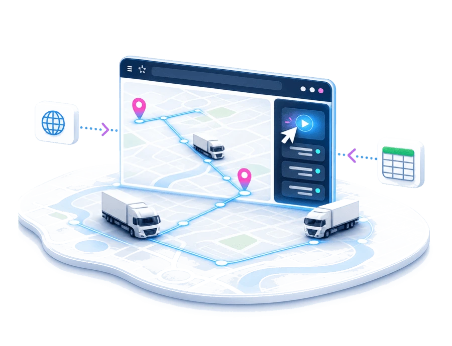
Plan, optimize and visualize tours quickly and online. With PASS MAPS, you manage routes for trucks, vans and service fleets directly in your browser — without complex system integration.
Plan easily
Create and optimize ad-hoc tours in just a few steps, without extensive configuration or long preparation.
Visualize clearly
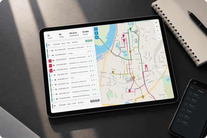
Keep tours, stops, daily schedules and status information in view on the map, and instantly see which stops are planned.
Get started quickly
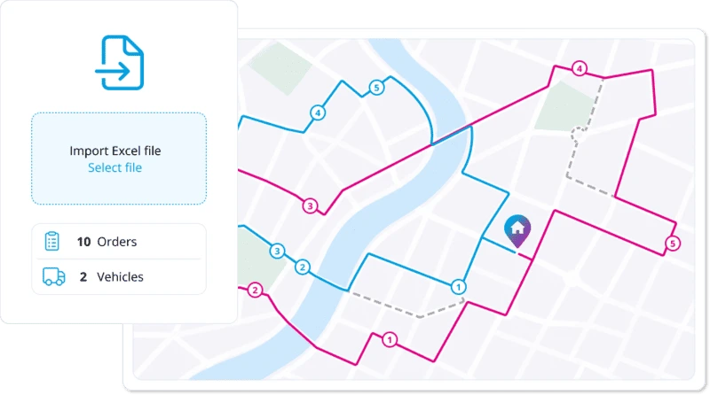
Import planning data via Excel and immediately create initial tour suggestions for review.
















Online route planning made easy
Plan tours quickly and easily
PASS MAPS supports operational tour planning with an intuitive workflow that requires no lengthy preparation. Existing order and vehicle data is used to generate tour suggestions that planners can review, adjust and optimize.
- Planning in just a few steps: Orders and vehicles are turned directly into planned tours.
- Compare planning scenarios: Different planning options can be compared and adjusted as needed.
- Clear tour visualization: Planned tours, stops and sequences are shown clearly on the map.
Keep ETA and tour status in view
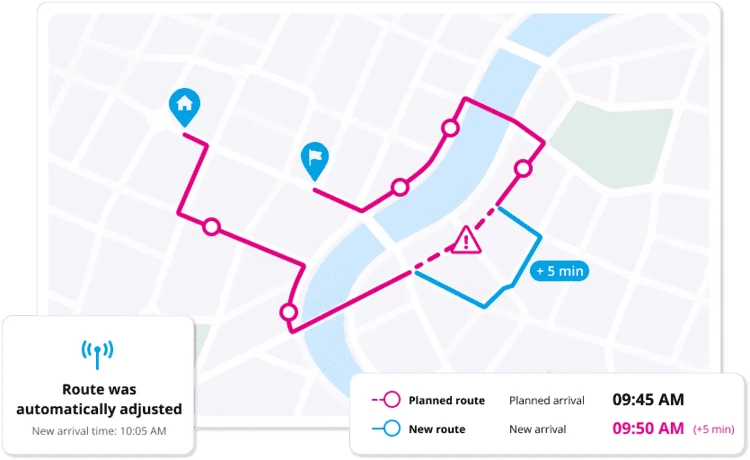
Current position and tour data are brought together centrally in the control center. Dispatchers can quickly see where vehicles are, whether orders are on schedule and where action may be needed.
- Live tracking: Vehicles and orders can be tracked in real time via MAPSERVICES telematics.
- Reliable ETA: Current position, traffic and delay data are included in the arrival forecast.
- Central tracking dashboard: Ongoing tours, vehicles and orders can be monitored clearly, making deviations easier to access.
Plan electric fleets realistically
PASS MAPS also enables realistic tour planning for electric fleets. Range, charging times and energy consumption are automatically taken into account to create feasible tours.
- Real E-truck models: A growing database with actual vehicle data supports precise planning.
- Intelligent charging management: Charging points and charging processes are planned to fit the tour.
- EV simulation: Existing diesel vehicle tours can be checked to see whether they can be operated with an electrified fleet.
Range forecasts
Forecast models based on Bosch Energy Consumption Prediction take vehicle- and route-specific data into account.


Optimize tours directly online
Get to know PASS MAPS in a demo and see how you can plan, visualize and, if needed, track tours live directly in your browser.
Typical use cases
PASS MAPS is especially suitable for teams that want to plan, adjust or visualize tours quickly, clearly and directly in the browser.
- Small and medium-sized fleets, that want to get started without a complex system implementation.
- Regional dispatch teams, that coordinate clearly defined tours and service areas.
- Service and field service control centers, that need to plan, manage and monitor assignments quickly.
- Ad-hoc planning for deviations, when short-term changes or new orders arise.
- Visualization for management or external stakeholders, when tours, routes and status information need to be easy to understand..
Which solution fits your tour planning needs?
|
PASS MAPS
Simple operational planning
|
PLANTOUR
Structured control of complex tours
|
|
|---|---|---|
| Setup & use How quickly you can get started |
Ready to use directly in the browser — no installation required. |
Planning system for permanently organized route planning processes. |
| Data & orders How planning data is integrated |
Import orders and vehicles easily via Excel. |
Shared data basis for orders, vehicles and planning rules. |
| Planning scope Which structures and planning areas can be covered |
For local, clearly defined planning areas. |
For territories, regions and organizational units. |
| Teamwork How users work together in planning |
For fast operational planning by individual users. |
Multiple dispatchers work in parallel in the same planning system. |
| Planning depth How comprehensively tours are planned and managed |
Ad-hoc planning, visualization and live tracking. |
Strategic, tactical and operational planning in one system. |
| Control & configuration How flexibly processes can be adapted |
Lean, fast and focused on day-to-day operations. |
With extensive configuration and control options. |
| Best suited for Best suited teams and processes |
Operational teams, service teams and control centers. |
Coordination of complex logistics processes. |
Grow with your requirements
A switch from PASS MAPS to PLANTOUR is possible at any time as organizational or functional requirements grow.
Do you already use an ERP, TMS or your own software solution?
With MAPSERVICES, you can extend your existing solution with powerful map and logistics functions that integrate easily into your systems and processes.
What our customers say


“PLANTOUR is a great support for our service teams and project management. We had extensive and very specific requirements for our route planning and, together with PASS Software, were able to sustainably solve a central and important challenge for our business.”
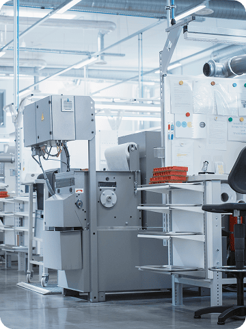

“Unlike in the past, we can now monitor every single pallet and allocate services down to the cent. At the end of the year, this naturally enables a completely different level of benchmarking.”


“PLANTOUR has been accepted by the dispatchers. For Steelcase, the decision was the right one, as the investment paid for itself within one year. Transport costs of €250,000 are saved year after year.”
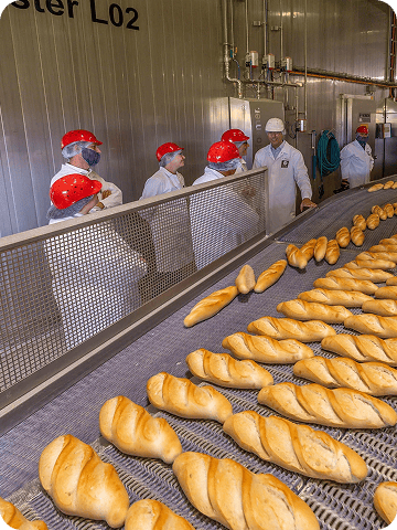

“With the PLANTOUR route planning system, the bakery Harry Brot GmbH improves its delivery punctuality and shortens routes: the optimized routes save 30 to 90 minutes per route and day.”
FAQ: Frequently Asked Questions from our customers
-
What is PASS MAPS?
PASS MAPS is a browser-based solution for logistics-related mapping, routing, planning and monitoring tasks. Companies can use it to visualize locations, plan routes, monitor vehicles and orders, or provide information through map views and dashboards. The range of functions can be adapted to the respective use case.
-
What is the difference between PASS MAPS and PLANTOUR?
PASS MAPS and PLANTOUR use the same technological and algorithmic foundation, but are designed for different areas of application. PASS MAPS provides streamlined, browser-based access for clearly defined planning, routing and monitoring processes. PLANTOUR also supports particularly complex and comprehensive dispatching and optimization processes.
-
Does PASS MAPS need to be installed locally?
No. PASS MAPS is accessed through a web browser and therefore generally does not require installation on individual workstations. Depending on their permissions, users can access the maps, routes, vehicles and analyses assigned to them.
-
Can PASS MAPS be connected to existing systems?
Yes. PASS MAPS can be integrated into existing IT environments and connected to ERP, transport management, merchandise management or telematics systems. This allows existing order, route or vehicle data to be imported and results to be transferred back to the primary systems.
-
What information can be displayed in PASS MAPS?
Depending on the use case, PASS MAPS can display locations, orders, planned routes, vehicle positions, route progress, deviations and estimated times of arrival. Shared map views and clearly structured dashboards can also be used to make information available within the company or to selected partners.
-
What types of companies is PASS MAPS suitable for?
PASS MAPS is suitable for companies that want to visualize logistics information, plan routes or monitor ongoing transports without introducing a comprehensive enterprise dispatching solution. It can be used for individual use cases as well as part of an integrated logistics platform.